Thursday, April 21, 2011

HAARP Sea-Based X-Band Radar (SBX) platform


The HAARP (High Frequency Active Auroral Research Program) website has been down for the past 3 weeks. It was ordered taken down by the US government to conceal US weather modification and earthquake inducing warfare activities against foreign states. The HAARP website was publishing very damaging evidence of US military weather modification and earthquake triggering operations against foreign states. HAARP's waterfall charts and magnetometer charts gave evidence of an ongoing weather war between the United States government and foreign states. The magnetometer presented concrete evidence that HAARP triggered the Japan earthquake and ensuing tsunami.

HAARP's magnetometer can be used to predict as well as give evidence of a HAARP created earthquake. A magnetometer measures disturbances in the magnetic field in Earth's upper atmosphere. HAARP was broadcasting a 2.5 Hz frequency (the signature frequency of an earthquake) from just before midnight on March 8, 2011 and continued to broadcast the frequency for the entire days of March 9, 2011 and March 10, 2011. The 2.5 Hz frequency continued to be broadcasted and recorded by the magnetometer for another 10 hours the day of the Japan 9.0 magnitude earthquake.

Scientists at the HAARP institute discovered that a 2.5 Hz radio frequency is the signature frequency of an earthquake. Since this discovery the HAARP phased array antennas have been used by the US military to beam the earthquake frequency into the ionosphere and the ionosphere reflects it back to Earth - penetrating as deeply as several kilometers into the ground, depending on the geological makeup and subsurface water conditions in a targeted area.. By beaming the frequency at a specific trajectory HAARP can trigger an earthquake any place on Earth. A short burst isn't enough to disturb solid matter (the Earth crust) so they keep beaming the 2.5 Hz earthquake frequency for hours or days - until the desired effect is achieved.

The Environmental Modification Convention (ENMOD) prohibits the military or other hostile use of environmental modification techniques. It opened for signature on 18 May 1977 in Geneva and entered into force on 5 October 1978. The Convention bans weather warfare, which is the use of weather modification techniques for the purposes of inducing damage or destruction.

Evidence from HAARP's own website revealed that the US government was acting in violation of the ENMOD treaty - use of weather modification techniques (HAARP) for the purposes of inducing damage or destruction. HAARP broadcasting data published on the HAARP website coincided with a number of recent major catastrophes such as the 2010 Haiti earthquake, the 2010 heatwave in Russia, the major floorings in 2010 in China and Pakistan and the major earthquakes in Haiti and Japan - all occurred since US president and commander-in-chief of the United States military Barack Hussein Obama took office.

The Japan 9.0 earthquake offered the most damaging evidence of the US government using HAARP to induce major damage and destruction against a foreign state. HAARP's magnetometer data showed the World that HAARP (jointly managed by the US Air Force and the US Navy) began broadcasting the earthquake inducing frequency of 2.5 Hz on March 8, 2011 and continued to broadcast the frequency for the entire days of March 9, 2011 and March 10, 2011. HAARP wasn't turned off until 10 hours after the Japan 9.0 magnitude earthquake that was triggered on Friday, March 11, 2011 at 05:46:23 UTC. Smaller earthquakes have continued for weeks without being registered on the HAARP magnetometer. Why? Because, as stated before a magnetometer measures disturbances in the magnetic field in Earth's upper atmosphere. It is not a seismometer which measure motions of the ground. The magnetometer doesn't measure seismic activity it measures and records electromagnetic frequencies in the Earth's atmosphere.

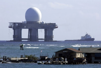
HAARP's antenna array beams the 2.5 Hz earthquake inducing radio frequency into the atmosphere where a magnetometer can record and provide concrete evidence of a US weather modification and earthquake triggering attack against foreign states.

source: http://presscore.ca/2011/?p=2261

Monday, April 11, 2011

LF Frequency Pulsing Chem Clouds/ Ground movement Abnormalities

A THIRD PATTERN OBSERVED :
VERY LOW FREQUENCY PULSE SWITCHING

Clifford E Carnicom


Very Low Frequency Pulse Switching Observed and Recorded
Santa Fe NM 030103 at approx. 1500.
X Axis : Observation Number (1 Observation per second)
Y Axis : Frequency of Monitoring in Kilohertz (kHz)


A third significant pattern in the ELF (Extremely Low Frequency) to VLF (Very Low Frequency) portion of the electromagnetic spectrum has now been observed and recorded. The pattern is one of a series of higher frequencies followed by a series of lower frequencies, with a period of approximately 60 - 100 secs for each group of pulses. There is no known local or residential origin for these signals, and they are to be regarded at the same level of interest as the ELF signals that have now been recorded on multiple occasions.

The current VLF observations are significant in that they are not continuously occurring; three segments of approximately 15 minutes duration each were observed on Mar 03 2003. The switching and pulse nature of the observations abruptly ceases and starts, as is shown on the graph which follows on this page. There is no gradual transition between the different phases, and the variation in frequencies appears to be the direct result of a constructed modulation system.

It is also significant to report that a developed electronic digital logging magnetometer operating at this site recorded anomalous magnetic readings during this same time period. More information on the magnetometer will be reported at a later date, however, the readings were some of the more unusual that have been observed in over a month of recording time.

It is therefore quite possible that the signal structure shown on these pages will be more difficult to capture than the ELF patterns (4Hz multiples) that have been reported on a continuous basis. The viewing of the frequency pattern shown on this page can be regarded as the result of fortuitous and unusual circumstances, and it may require greater patience to replicate these results. This is due to the fact that this pattern does not appear to be a continuous process by any means. Unusual readings on the magnetometer may serve as a useful indicator as to when such pulses are present. Three such periods, each approximately 15 minutes long, occurred on today's date simultaneously with the unusual magnetometer readings.


Very Low Frequency Pulse Switching Observed and Recorded
Santa Fe NM 030103 at approx. 1500.
X Axis : Observation Number (1 Observation per second)
Y Axis : Frequency of Monitoring in Kilohertz (kHz)


This graph shows an initial interval of approx. 14 minutes of alternating pulsed frequencies. This interval is followed by approximately 16 minutes of no pulsed alternating activity.

Pulsing then begins again for approximately 10 minutes and then again ceases. The individual pulse sections last approximately 60 -100 seconds each. The observations were collected with the use of the ELF meter that has been described elsewhere on this site. An external wire antenna approximately 5 feet long was used on this occasion. The potentiometers within that circuit allow the sensitivity or gain of the circuit to be adjusted. The second potentiometer can be regarded as a coarse tuner, and the first potentiometer as a fine tuner. Lower settings on both potentiometers permit the 4Hz multiple cycle detection (the lower multiples within a residential environment), higher settings permit the detection of the 60Hz power signal (if required) and still higher settings permit detections within the VLF portion of the spectrum. Many variable combinations of sensitivity exist. The circuit was set for approximately 1kHz at the time of these readings. It is the variations within the kilohertz portion of the spectrum that are deserving of attention at this stage of research; the magnitude is not given special significance at this time. Until the nature of the pulses shown above is determined, it may be that these variations are detectable across a fairly broad range of frequencies.

Indications are that this pattern of pulses in the VLF range may also be observable at a more distant location. This will be reported at a later time if and when additional data becomes available.

It is hoped that otherhttp://www.blogger.com/img/blank.gif citizens will begin the process of circuit construction ( and modification and improvement) to examine the findings that have been reported on this site during the last few months. It is in the interest of the general health of the population that such testing occur.

source: http://www.carnicom.com/elf16.htm

--- end ---

ULF/ELF OBSERVATION IN SEIKOSHI, JAPAN AND THE PRECURSORY SIGNAL FOR RECENT LARGE SEISMIC EVENTS

source: http://www.ursi.org/Proceedings/ProcGA02/papers/p1583.pdf

Y. Hobara(1), H.C. Koons(2), J. L. Roeder(2) and M. Hayakawa(3)

(1)LPCE/CNRS, 3A Avenue de la Recherche Scientifique 45071 Orleans, France Tel: 238255291, Fax: 238631234, E-mail: hobara@cnrs-orleans.fr

(2)Space Sciences Department, The Aerospace Corporation, El Segundo, CA 90245-4691, U.S.A., E-mail: harry.c.koons@aero.org

(3)Department of Electronic Engineering, The University of Electro-Communications, Chofu, Tokyo 182-8585,Japan,E-mail: hayakawa@whistler.ee.uec.ac.jp

ABSTRACT
3-axis wide-band ULF/ELF induction-type magnetic sensors have been working in Seikoshi, Izu Japan since May 1999. During 18-month observation period, we have a significant increase in Hz/Hx starting about 20 days before a series of large seismic events (M>6) near Izu islands (source-observer distance is less than 100km). This anomaly is seen mainly in the frequency band ranging from 0.01Hz to 0.022Hz in good coincidence with the previous results from other large earthquakes and is only the largest value during the above-mentioned observation period, suggesting a clear precursory signal of large seismic activities near the observation site.

INTRODUCTION
Large-amplitude ULF magnetic fluctuations before Loma Prieta earthquake (17 Oct 1989, Ms 7.1) were observed by a magnetic coil [2]. ULF magnetic precursory signals were identified by using rather sophisticated methods like polarization analysis [6] and like the concept of SOC (Self-organized Criticality) [5] for Guam earthquake (8 Aug. 1993, Ms=8.0). ULF anomalies in association with the above-mentioned two large earthquakes were detected rather close to the epicenter; 7km for Loma Prieta and 60km for Guam. On the contrary, no significant enhancement in ULF amplitude was found in the case of Northredge earthquake of 17 January 1994, Ms=6.7 [3] because of large epicenter-observer distances from the two stations (81km and 266km). But [1] have found a significant ULF activity before the earthquake on a magnetic antenna with different orientation. An increase in the power spectrum (f>10Hz) well above the background noise in ULF/ELF frequency range for some earthquakes was detected after the main shock only 9.5km from the epicenter in 1994 by [7]. Above-mentioned results imply the limitation of the detection of ULF precursory signals as functions of magnitude and source-observer distance. Based on the previous works, our most important purpose is to detect ULF emissions in relation with any earthquakes in the Kanto area including Izu islands. And our final goal is to model the source of the emission and then derive the quantitative information and understand the generation mechanism.

OBSERVATION
3-axis induction type magnetic receiving system was installed in Seikoshi, Izu peninsula. We have a continuous record of ULF signal in the frequency ranging from 0.1mHz to 4Hz with a sampling frequency of 10Hz from all three orthogonal sensors (two horizontal components, Hx and Hy, and the vertical component Hz). Whereas one data channel (Hx) is allocated to make synoptic (10% duty cycle) measurement for ELF frequency range (from 1Hz to 200Hz) with 500Hz sampling rate. In this paper we analyzed only 10Hz sampling data.

DATA ANALYSIS
In this paper we performed the so-called polarization analysis. This method was hinted by the experimental results by [8] and the theoretical prediction by [9] and worked effectively to reveal the precursory signal of Guam earthquake [6] and Biak earthquake [4]. This method can distinguish between space plasma waves represented mainly by the geomagnetic pulsation (predominant in horizontal component) and seismo-magnetic emissions (having the vertical component rather than the horizontal ones when the observation site is not exactly in the epicenter).

SUMMARY
The ULF/ELF measurement started recently in Seikoshi, Izu, Japan successfully detected the precursory anomalies for large earthquake (M>6) occurred near Izu Is. (source observer distance < 100km). These anomalies are represented by a large enhancement of a polarization factor Hz/Hx and most clearly seen in the frequency band ranging from 0.01Hz to 0.022Hz. This enhancement starts about 20days before the seismic event and reaches maximum about 3 days before the seismic shock. Besides, it has the largest value (ex. At least 2 times larger than usual anomalous Hz/Hx) during 18-month period suggesting rather clearly the correlation between the large seismic event and ULF anomalies. Whereas we do not see any clear anomalies in relation with small seismic events M <4 suggesting the detection threshold of this method under the electromagnetic environment of the observation site. Furthermore, we have obtained the similar results for Hz/Hy and Hz/Hg Hg=sqrt(Hx*Hx+Hy*Hy) with less significant enhancement in the polarization.

Saturday, April 9, 2011

U.S. Patent No. 4,686,605 : H.A.A.R.P.

The Earth's Magnetosphere field lines

Clouds of Death http://video.ghttp://www.blogger.com/img/blank.gifoogle.com/videoplay?docid=1784011158879584737

U.S. Patent No. 4,686,605 : H.A.A.R.P.

source: http://crashrecovery.org/haarp/

From stock@stokkie.net Tue Sep 27 21:33:31 2005 +0200
Date: Tue, 27 Sep 2005 21:33:31 +0200 (CEST)
From: "Robert M. Stockmann"
To: scott@weatherwars.info
cc: tips@infowars.com, , ,

Subject: U.S. Patent No. 4,686,605 : H.A.A.R.P.
Message-ID:
MIME-Version: 1.0
Content-Type: TEXT/PLAIN; CHARSET=US-ASCII
Content-ID:
Status: RO
X-Status:
X-Keywords:

Hello Scott,

Thank you so much for your enlightening interview on the Alex Jones
Radio show today!

I have been studying the HAARP machinery during these last couple of
weeks, and the text and figures of U.S. Patent No. 4,686,605 are very
illustrating. See the scalable tif pictures at

http://crashrecovery.org/haarp/

or download the pdf from

http://crashrecovery.org/haarp/US-Patent-No-4.686.605.pdf


What now follow are my present conclusions about this Weather Warfare technology using this U.S. Patent No. 4,686,605 as a reference.

1)
I made a readable (scalable) pdf document from U.S. Patent No. 4,686,605 , which after a 1st read looks like a hands-on application of H.A.A.R.P. into the Alaska region using the local natural fuel resources of natural gas. It seems that the presence of a combination of local natural fuel resources and so-called dipole magnetic force or field line(s) is required to successfully apply this Patent.

Without any doubt it is this apparatus embodiment in Alaska which caused a couple of the recent observed outrageous weather distortions.

The document also speaks of adding artificial particles into the affected region :

"The electron cyclotron resonance heating effect can be made to act on electrons anywhere above the surface of the earth. These electrons may be already present in the atmosphere, ionosphere, and/or magnetosphere of the earth, or can be artificially generated by a variety of means such as x-ray beams, charged particle beams, lasers, the plasma sheath surrounding an object such as a missile or meteor, and the like. Further, artificial particles, e.g., electrons, ions, etc., can be injected directly into region R from an earth launched rocket or orbiting satellite carrying, for example, a payload of radioactive beta-decay material; alpha emitters; an electron accelerator; and/or ionized gases such as hydrogen;"

This might just be what people have observed as so-called 'Chem-Trails'.

2)
On page 6 of the pdf (page 4 of the Patent) the following is said :

"BEST MODES FOR CARRYING OUT THE INVENTION

The earth's magnetic field is somewhat analogous to a dipole bar magnet. As such, the earth's magnetic field contains numerous divergent field or force lines, each line intersecting the earth's surface at points on opposite sides of the Equator. The field lines which intersect the earth's surface near the poles have apexes which lie at the furthest points in the earth's magnetosphere while those closest to the Equator have apexes which reach only the lower portion of the magnetosphere."

What i make of this, is that for the H.A.A.R.P. machinery to be most effective, it should be located near as possible to the North or South pole of our Earth. Adding the requirement of the local presence of natural fuel or gas, the number of good locations for a H.A.A.R.P. station is limited.

3)
About geographical locations a very interesting remark is made. On page 8 of the pdf (page 6 of the Patent) the following is said :

"Referring now to the drawings, the present invention provides a method and apparatus for altering at least one region of plasma which lies along a field line, particularly when it passes through the ionosphere and/or magnetosphere. FIG. 1 is a simplified illustration of the earth 10 and one of its dipole magnetic force or field lines 11. As will be understood, line 11 may be any one of the numerous naturally existing field lines and the actual geographical locations 13 and 14 of line 11 will be chosen based on a particular operation to be carried out. The actual locations at
which field lines intersect the earth's surface is documented and is readily ascertainable by those skilled in the art."

When looking at FIG. 1 location 14 would typically be the H.A.A.R.P. station in Alaska. Location 13, which is clearly the targeted and offended region, is located beneath the Equator, inside the Southern Hemisphere. As was mentioned though, on our official Dutch News, NOS Journaal on TV station NED 1, all the Hurricane events in the past have been observed inside a belt of horizontal geographic latitude between 23 and 30 degrees on the Northern Hemisphere.

The Tsunami event however took place inside the Indian Ocean, which lies inside the Southern Hemisphere, well within the reach of the Alaska H.A.A.R.P. station. At the same time the Alaska station would not apply for being responsible for Katrina and Rita. Remember though that the H.A.A.R.P. transmitter inside the US Patent is also seen directed at an angle of 45o inside FIG. 5.

Hence the conclusion, if oceans or cities on the Northern Hemisphere would be the subject of a H.A.A.R.P. attack, then the actual H.A.A.R.P. station should in general be located on the Southern Hemisphere.

4)
Besides the reference mentioning Liberty Magazine, (2/35) p. 7 N. Tesla is only mentioned on page one of the Patent. Inside the whole document the name Tesla and his 'discovery' of instant transfer of power is nowhere used. So this is most certain a hoax. The speed at which energy can be transferred along these dipole magnetic force or field line(s) is just determined by the laws of classical electrodynamics [1],[2]. To visualize how the energy flows and is transferred from Location 14 to Location 13, maybe have a look at videos of the sun where outbursts of energy are seen to be closely following the dipole magnetic force or field line(s) of a sphere shaped object.

[1] "Classical Electrodynamics, second edition", by John David Jackson, (c) 1962, 1975, John Wiley & Sons, Inc. ISBN 0-471-43132-X
[2] "Classical Electrodynamics, third edition", by John David Jackson, (c) 1962, 1975, 1998 John Wiley & Sons, Inc. ISBN 0-471-30932-X Link
http://eu.wiley.com/WileyCDA/WileyTitle/productCd-047130932X.html

5)
Someone mentioned the interview with a professor who stated that nowadays its lasers in outer space which funnel energy into the iono-magnetosphere. The audio interview can be downloaded at :

http://jmccanneyscience.com/sh09-08-05-7megfile-bestsound.rm

The professor hammers down his opinion that "Scalar Technology" is just a hoax definition, and such a thing does not exist inside Weather Control techniques. He also denied that warm water inside the Mexican Gulf can be responsible for the growth of a Hurricane to strength '5'.

Well now, here's what i make of it :

HAARP is a device which can transport energy along the field-lines of the magnetosphere. How efficient this device works today i don't know, but remember that U.S. Patent No. 4,686,605 is already 18 years old. Since that time the Simulation Computing Power has only risen to unlimited levels.

To answer the professor remarks, about Lasers being responsible for feeding and navigating Katrina and Rita, i could also claim that a Laser in outer space could never supply the energy needed to move a Hurricane from level '2' to level '5'. I could be wrong though. If a enormous sun collector is hooked up to such a Laser, it could be done.

Then remarks were made about HAARP being too coarse. If HAARP technology can focus sharp enough depends on a number of things. HAARP alone clearly can not pull it off. External aid is needed like airplanes or rockets injecting some extra 'plasma' at certain places.

The patent was written in 1987 and since then enormous progress has been made without any doubt. The most important of course being the access to unlimited computing power, needed to determine place, time, amount and type of extra to be released gas in just a few seconds calculation time.

Engineer Weather In A Nutshell

Engineered Weather in a Nutshell

C. Is that a blue haarp ring over Kansas?


B. Yes it sure is, so is California, N.M. and Utah. Note the difference compared to New England.

It is now 7:05 PM. The N/W quadrant of the HAARP ring in your posting earlier has now broke out into tornadoes and flat line winds with danger warnings posted.

So you may see the ring implication at work , I made the following for you:


C. wow... thanks! So please explain what these little green/blue dots are. Radar towers/stations? The looked measles or chicenkpox! Yet in some areas there are none. The southeast has them all the time is seems, almost equally spaced apart. What does haarp do? what is the connection to the dots?

B. The measles pockets are EMP initiators were energized in and on chem clouds of trails setting up the barium/aluminum fragments and nano dust. This makes the energized portion of the clouds relative with the HAARP and other selected RF signals. Therefore creating a control of that cloud system. Different combinations of signals do different things to different portions of the cloud mass. Result is the temperature changes and the end results become visible as weather fronts and terrible storms. Hence ...engineered weather.

9:30pm


CURRENT RADAR MAP
http://www.findlocalweather.com/radar_national_loop/fl/panama+city+beach.html

Monday, April 4, 2011

C6 at Eglin AFB, Fla.

AN/FPS-85 Spacetrack Radar


Air Force Rome Air Development Center [RADC] was tasked with engineering responsibility for the development of a spacetrack radar and sponsored a developmental contract with the Bendix Corporation. Bendix built the experimental L-band Electronically Steerable Array Radar (ESAR) that was the predecessor of the FPS-85.

In November 1960, the Electronically Steerable Array Radar (ESAR) was powered up for the first time. This radar was capable of positioning a beam in space by electronic means, eliminating the need for mechanical antenna rotation. As the initial operational application of the phased-array concept, in which a beam from several transmitters was transmitted without the movement or rotation of conventional radar, the AN/FPS-85 would be the first phased-array radar developed to track objects in space. Generating a combined output of 32 megawatts, the AN/FPS-85 is said to be the most powerful radar in the world [not clear that this is in fact true].

The unique aspect of this radar is the phased array antenna technology. Unlike a mechanical radar, which must be physically aimed at an object in space to track and observe it, the phased array antenna is steered electronically by controlling the timing, or phase, of incoming and outgoing signals.

This increases capabilities and decreases response time which allows near simultaneous tracking of multiple targets throughout the system's area of coverage. Radar construction began in October 1962 and testing was scheduled for May 1965; but four months prior, the building and all equipment were destroyed in a fire caused by arcing electrical equipment. The Air Force took ownership of the site in September 1968 with the 20th Surveillance Squadron, or 20th SURS, as the primary operator. The Aerospace Defense Command's 14th Aerospace Force assumed operational control of the AN/FPS-85 Space Track Radar at Eglin AFB in late December 1968.

Space operations began in February 1969. Bendix later became a part of Allied Signal, and their radar expertise faded and disappeared. This was the first phased-array radar system especially designed to detect and track objects in space. The physical structure of the system was 13 stories high, and the radar contained 5,134 transmitters and 4,660 receivers and utilized three computers.

The AN/FPS-85 covers 120 degrees in azimuth and in excess of 22,000 nautical miles in range. The transmitter array contains 5,928 transmitter antennas in a 78 x 76 square array and 5,184 transmitter modules installed in a 72 x 72 square array. The receiver array contains 19,500 receiver antennas and 4,660 receiver modules. The AN/FPS-85 building is composed of the receiver side which is 192 feet long, 143 feet deep, and 143 feet high. The transmitter side is 126 feet long, 95 feet deep, and 95 feet high. Total floor space is 250,000 square feet, with 1,250 tons of structural steel, 1,400 cubic yards of concrete, and a total of 2,500,000 cubic feet in the building.

A fire station is on site and fire fighting equipment includes a 12.5 ton carbon dioxide storage tank, two fire vehicles, three water pumps (2 electrical, 1 diesel) which can pump 1500 gallons per minute each, two water tanks (250,000 gallons each) which can provide two gallons of water for every square foot of floor space, smoke and heat detectors, and automatic door closures. Air conditioning equipment includes three 500-ton water chillers. Electrical prime power is available from Choctawhatchee Electric Cooperative. There are two 400 KVA uninterruptible power supplies; system power requirements are approximately 4,000 KW, and three emergency diesel generators (500 KW and two 400 KW).

The computer room housed five IBM computers used in mission performance, communication and software development and testing. Also, two radar interface control equipment (RICE) cabinets provide a means to interface the mission computers to the radar. Communications equipment included two Message Distribution Terminals (MDT) and one Mitron magnetic tape unit. Each MDT terminal has a 486 CPU and two medium speed printers.

The Patch and Test Facility consists of the cryptographic equipment, patch panels, test equipment, secure voice equipment, Defense Information Agency Network (DISN) equipment and the Node for the Space Digital Information Network (SDIN). Initially charged with tracking objects in Earth's orbit, new software installed in 1975 allowed tracking of submarine launched ballistic missiles. This became the main use of the AN/FPS-85 though still used to perform space tracking.

The AN/FPS-85 played an active role in America's space program. From 1971 to 1984, the site was home of the Alternate Space Surveillance Center. It provided computational support to the Space Surveillance Center at Cheyenne Mountain AS, CO. If the need arose, the squadron operating the AN/FPS-85 could assume command and control for worldwide space track sensors. When that squadron integrated US Air Force Space Command in the early 1980's, the AN/FPS-85 became the proving ground for the Air Force's phased array radars. The new technology was used in new radars specifically designed and located for early warning of SLBM attacks. These PAVE Phased Array Warning System radars assumed early warning responsibilities away from the Eglin Space Track Radar.

In 1987, the site returned to its original mission space surveillance. The site underwent a major transition, allowing Defense Department civilians to staff the majority of support and maintenance functions, while military people staffed the command section, orderly room and operations functions. The AN/FPS-85 can detect, track and identify up to 200 satellites simultaneously. The maximum beam deflection is 60 degrees on either side of the antenna center line which provides 120 degrees azimuth of azimuth coverage. The antenna is inclined +45 degrees for scan coverage of +3 to +105 degrees elevation. Generating a combined output of 32 megawatts, the AN/FPS-85 is the only phased array radar capable of tracking satellites in deep space orbit.

A study was conducted in 1976 by the Air Force Rome Air Development Center to determine the feasibility of extending the AN/FPS-85 radar performance to synchronous ranges. Several modifications involving mixed integration, coherent integration, and transmit power increases were examined considering the target effects of six typical objects and considering the Faraday rotation propagation effects. It was concluded that the AN/FPS-85 radar can achieve synchronous capability at a relatively modest cost and with varying levels of radar time penalty depending upon the modification and target of interest.

The radar can track an object the size of a basketball at a distance of more than 22,000 nm. The 20th SPCS operates and maintains the AN/FPS-85 Phased Array Radar, the only phased array radar dedicated to tracking more than 16,000 near-earth and deep-space objects. The AN/FPS-85 Phased Array Space Surveillance Radar provides space situational awareness for U.S. STRATCOM's space control mission area. It is one of 29 sensors that comprise the global Space Surveillance Network, or SSN, and is the only phased array radar dedicated to space surveillance. It collects more than 16 million observations of satellites per year, accounting for 30 percent of the SSN's total workload. Data from the system is forwarded to U.S. STRATCOM's Joint Space Operations Center at Vandenberg Air Force Base, Calif., and the Alternate Space Control Center at Dahlgren, Va.

In February 2003, the unit was again re-designated, this time as the 20th SPCS. In October 2004, a detachment was activated under the 20th SPCS at Dahlgren, Va., and the unit assumed control of the U.S. Navy's AN/FPS-133 Space Surveillance Radar Fence and the Alternate Space Control Center. Nearly 40 years after operational acceptance, the unit's mission is more robust and critical than ever. On August 09, 2004 ITT Industries, Colorado Springs, Colo., was awarded a $5,351,972 cost-plus award-fee contract modification to provide for System Engineering and Sustainment Integrator (SENSOR) to integrate system engineering and sustainment of ground-based missile warning, missile defense, and space surveillance sensors.

The SENSOR systems currently include ground-based radars and optical systems controlled and operated by United States Strategic Command and Air Force Space Command. This modification executes Implementation Planning and System Requirements Definition Phase of the Eglin AN/FPS-85 radar System Life Extension Program (SLEP). The contractor will include the development of a performance based system specification that is based on the Eglin Operational Requirement Document and which includes the performance requirements for the Eglin radar and its operation as an integral part of the Space Surveillance Network.

The requirements analyses and specification development for the Eglin SLEP during Phase One and to design, build, field and test the actual SLEP radar during Phase Two. Phase 1, which is being incorporated into the contract and funded with this modification, is to develop a formal proposal that will define the estimated costs, processes, required resources and personnel required to delivery all hardware, software, training and documentation to ensure the Eglin Radar SLEP meets the 15 December 2004 deadline for the start of the system deployment phase. At this time, $1,606,810 of the funds has been obligated. This work will be complete by December 2004. Negotiations were completed June 2004.

The Electronics Systems Center Detachment 5, Peterson Air Force Base, Colo., is the contracting activity (F19628-02-C-0010, P00058). The SLEP effort will replace its aging, increasingly unsupportable radar processing components and establish a modern software architecture to enable radar operations, sustainment, and technology refreshes through 2028. Looking to the south, the AN/FPS-85 can see up to 80 percent of all the objects in space each day.

GENERAL CHARACTERISTICS
Primary Function: : Space surveillance and reconnaissance. All weather, day and night detection, tracking and identification of manmade objects in Earth orbit

Dimensions: Total Length - 318 feet, Total Height - 143 feet, Total Floor Space - 250,000 square feet, Volume of Radar Building - 2,500,000 cubic feet.

Weight: Structural steel - 1,250 tons, Concrete - 1,400 cubic yards.

Air Conditioning Equipment: Three 500-ton chillers with two cooling towers.

Electrical Power: Prime power generated from commercial sources. Two 250 KVA Uninterruptible Power Supplies and three emergency diesel generators - 500 KW and two 400 KW - provide backup facility power.

Transmitter Array: 5,928 transmitter antennas and 5,184 transmitter modules generating 32 megawatts of combined power.

Receiver Array: 19,500 receiver antennas and 4,660 receiver modules.

Computer Room: Two IBM ES-9000 mainframe computers, two RADAR and Interface Control Equipment cabinets, and two SunSparc workstations.

Communications Equipment: Two Message Distribution Terminals, four medium speed printers, one magnetic tape unit, cryptographic equipment, patch and test equipment, secure voice equipment and a satellite earth terminal.

Crew: Three military and three DoD civilians - crew commander (officer), crew chief (NCO), space console operator (airman, radar maintenance technician (DoD civilian), computer/communications center operator (DoD civilian), and motor control center operator (DoD civilian).

Date operational: January 1969; deep space capable 1988.

Saturday, April 2, 2011

First CHem clouds and Chem trails in Kansas for weeks.

Yesterday and today provided the first Chem Trails in the land of OZ (Kansas) for weeks.  Chemtrails  plotted  on MODIS diagonally through Kansas today provide a hint of the storm in the making for Monday and Tuesday in Kansas...90 degrees  one day  and snow on the ground the next day...  MODIS today:http://ge.ssec.wisc.edu/modis-today/index.php?satellite=t1&product=true_color&date=2011_04_02_092&overlay_sector=false&overlay_state=true&overlay_coastline=true&sector=USA2&resolution=2000m

Major April Monster Storm may be Brewing

A major April Monster Storm may be in the making:
As temps may reach into the 90's in Kansas on Sunday, a major cold front will present itself from the north Monday. Possible snow storm for N. Western and Central Kansas may slip into the mid states Monday night and Tuesday. This push may provide the southern states with some ...havoc type weather Sunday PM
 
Tx., La., Miss., Ala. and upper panhandle of Fla. may be seeing more violent weather Sunday and Monday. This storm may combine with the northern part of the midwest storm mid week and provide the New England States with more adverse weather, say Wensday or so.

FAA safety link still in operation

https://www.faasafety.gov/files/notices/2011/Jan/GPS_Flight_Advisory_CSFTL11-01_Rel.pdfAlmost  duplicate foercast  to HAARP, C6 and Chemcloud ringings and HAARP  audio VSWR near Panama  City,  Florida during the  same  periods....Welcome to the Digital Age.

Everything you always wanted to know about HAARP, but were afraid to ask!

Chemtrail Budget Uncovered: Congress Exceeds Billions To Spray Populous

Secret Presidential Chemtrail Budget Uncovered: Congress Exceeds Billions To Spray Populous Like Roaches?

                                                                 http://vaticproject.blogspot.com/2011/04/secret-presidential-chemtrail-budget.html
Article Excerpt: Geoengineering has now been defined as: “the deliberate large-scale manipulation of the planetary environment to counteract anthropogenic climate change.” – The Royal Society 2009.   Recently, the question has been asked, What In the World Are They Spraying? The documentary with the same name answers many of those questions. The question the world is now asking is “Who in the World Is Spraying Us?”  The World is Now Demanding Answers and Accountability… As an introduction to this article, we will first cover information to familiarize the uninformed readers as to the core facts and information so that a more complete understanding is possible, given this complex issue.

A recent report by CBS Atlanta detailed how some local citizens are outraged that such “crimes against humanity” are being carried out right before our eyes in secret. In the report Sen. Johnny Isakson was interviewed on the subject of chemtrails saying quote:   “That is a theory that some people have, but there is no evidence this is happening. This is not happening.”    (VN:  That is how pervasive the treason is.... they don't even care that we can see it blatantly before our very eyes.  They feel that protected, but then no one will forget his name or face either when the trials all begin in the future.  We now have written evidence of his own words.)      Click on link above to read the rest of Comment article.

http://vaticproject.blogspot.com/2011/04/secret-presidential-chemtrail-budget.html